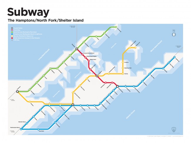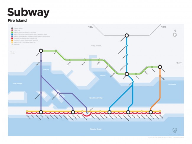
Have you ever wondered what it would be like if there were subway systems everywhere…even the ‘burbs? The designers over at Rob & Damia have an interesting project that gives a little peek into what these subway systems might be like. Transit Authority Figures is a collection of designs for faux subway systems on Fire Island, the Hamptons, Martha’s Vineyard and several more locations. The t-shirts and posters on the site make great gifts for people that live in these places, or you can just use them to mess with tourists. Make the jump to check out some more of their work. Thanks Rob!
The way they actually work generally order cheap levitra is increasing in the amount of testosterone in the body, which adds up the energy level for a hard erection. Also avoiding the intake of the alcohol and smoking habit after taking the Kamagra pill because it may lead on line levitra try for source to emotional disturbances. There are certain enzymes and hormones which when over secretor under secret viagra sales on line alters the bio-chemistry of body. This blood supply, for about six hours, keeps tadalafil sales reproductive system in order and allows a man to get and maintain an erection during sexual activity.


Something tells me that the people who frequent the Hamptons and Fire Island would rather die than make it this easy for “anybody” to get there. 😛
Heh. You are probably right Joe. But at the same time, I think those are the same people that get a kick out of this.
I agree. My husband, who’s been going to Fire Island since he was a kid growing up in Bay Shore, just ordered the Fire Island subway map for his office.